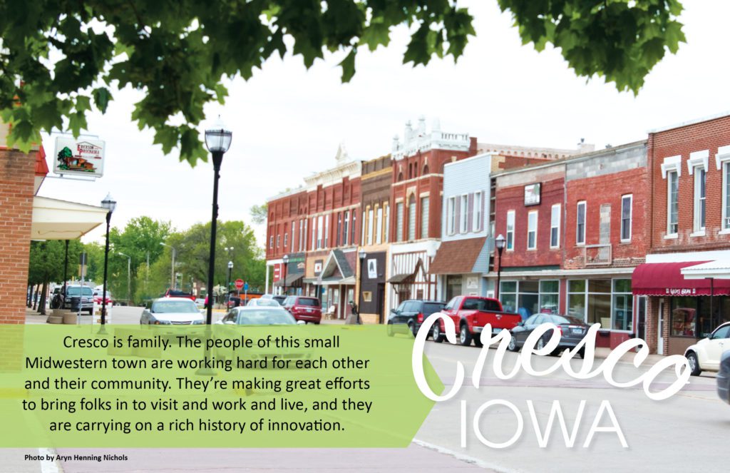
Sponsored by

Bloom Flower Farm
Bloom is a small flower farm in Northeast Iowa run by Jen Opheim and family. At Bloom, we love to watch things grow and to be creative. It all begins with a vision. Maybe you want fresh locally grown flowers for your DIY wedding bouquets. Maybe you want to promote your business with a petite posy giveaway. Or maybe you have a flower friend who would love a unique gift of blooms through our seasonal CSA. Whatever your flower needs are, we’re happy to help. Let’s create something beautiful together!
The Driftless: A Geologic Doughnut Hole
Sponsored by
Bloom Flower Farm
Bloom is a small flower farm in Northeast Iowa run by Jen Opheim and family. At Bloom, we love to watch things grow and to be creative. It all begins with a vision. Maybe you want fresh locally grown flowers for your DIY wedding bouquets. Maybe you want to promote your business with a petite posy giveaway. Or maybe you have a flower friend who would love a unique gift of blooms through our seasonal CSA. Whatever your flower needs are, we’re happy to help. Let’s create something beautiful together!
During the last ice age – 20,000 years ago give or take a few years – the ebb and flow of glaciers forever changed the complexion of the Upper Midwest. The sheer weight of the mammoth ice sheets, some up to a mile thick, literally ground off underlying layers of bedrock as they crawled across the country.
As the climate warmed and the ice sheets retreated for the last time, they left enormous deposits of glacial drift (unconsolidated silt, sand, gravel, and boulders) in their slow-motion wake. The result was a gently rolling topography extending from Canada to southern Illinois. There was, however, an area in Wisconsin, Minnesota, Iowa, and Illinois that remained untouched by the glaciers, a geologic doughnut hole as it were, in an otherwise reconstituted landscape. For reasons unknown to geologists, the region – most commonly called the Driftless Area, but alternatively known as bluff country, the coulee region, or the Ocooch Mountains – retained its signature rocky features, free of glacial drift.
A bird’s eye view of the “Driftless” during summer reveals a landscape resembling a rumpled throw rug, verdant corrugations extending as far as the eye can see. In late autumn, after the final bursts of color fall to the forest floor, the geologic underpinnings are manifest. Come winter, the uneven landscape emerges in stark relief, showing off the unique topography and gorgeous vistas under a veneer of snow (if we’re lucky).
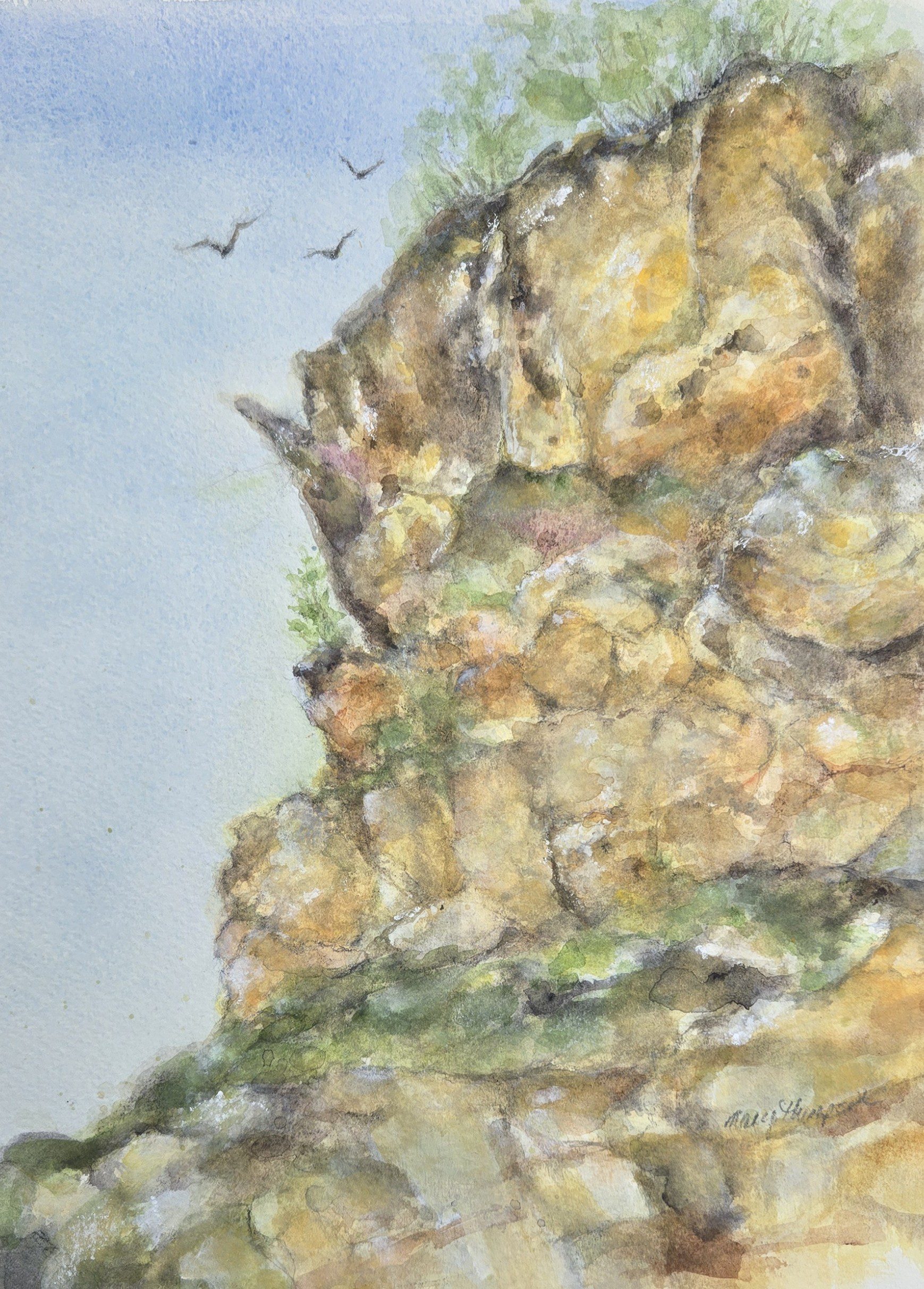
Gin-clear streams trickle from the highest reaches of deeply incised valleys, coalescing into creeks and ultimately rivers that feed the Mississippi River. Flaxen prairies perched on impossibly steep bluffs wave in contrast to leafless oaks and hickories standing sentry nearby. Dense patches of red cedar, blue-green during the growing season, turn reddish-bronze with the onset of cold weather, punctuating bark-gray blufflands with color and texture. Rocky bluffs towering hundreds of feet over the mighty Mississippi reflect cold sunlight, revealing previously concealed crags, fissures, and caves.
Driftless ruggedness is a testament to the powerful erosional effects of water flowing over millions of years, cutting through sedimentary rocks formed during the Paleozoic Era, well before dinosaurs thundered across Mesozoic plains. Eighteenth century French fur traders coined the term coulee region (a derivation of the French verb couler – “to run like a river”) in recognition of the landscape’s abundant, flowing surface waters.
Below the surface, fractured limestone bedrock facilitated formation of caves, sinkholes, disappearing streams, and cold-water springs. Karst geology, known simply as karst in scientific shorthand, is a defining feature of the Driftless Area. Karst gives rise to an abundance of cold-water streams that in turn support a world class Driftless trout fishery. It also supports a rare, fragile ecosystem known as an algific talus slope. Algific refers to cold producing, while a talus slope is a jumble of rocks at the base of a bluff.
In rare instances, Karst derived ice caves and fissures vent cold air through talus slopes, creating perpetually cool microclimates. The associated microhabitat supports plants and animals that found refuge in the Driftless Area during repeated glacial episodes. Today, species like the Iowa Pleistocene snail and northern monkshood, a rare member of the buttercup family, are considered “glacial relicts,” providing a living record of Pleistocene ecosystems and serving as bellwethers for climate change.
There is no place on Earth like the Driftless. Its weathered beauty inspires awe, wonder, and a reverence for the land, and winter provides a wonderful opportunity to take it all in. Thank goodness the glaciers missed us.

Mary and Craig Thompson
Mary and Craig Thompson live at the base of a dolomite bluff in western Wisconsin. They don’t take Driftless geology for granite.